Ineia station (CAO-INE)
Ineia station (CAO-INE)
-
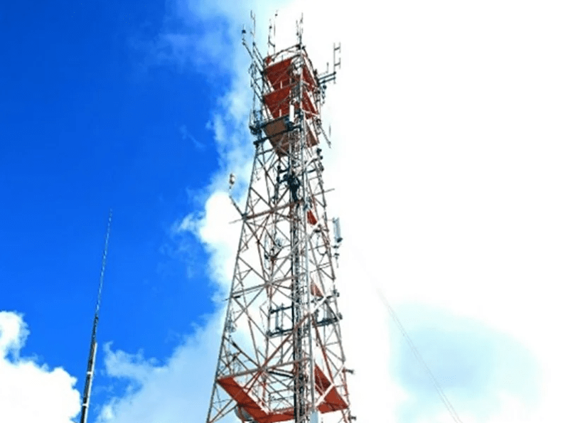
 The site includes a private facility with a tower, where instruments continuously sample air and record weather data. These instruments are housed in an air-conditioned room at the base of the tower, ensuring accurate and reliable measurements throughout the year.The INEIA observatory follows the standards of an ICOS Atmosphere Class 2 station, designed to provide high-quality, continuous measurements of greenhouse gases and meteorological conditions.The station is equipped with:
-
Greenhouse Gas Analyzers: High-precision instruments continuously measure carbon dioxide (CO₂), methane (CH₄), and carbon monoxide (CO) concentrations. These analyzers are calibrated regularly using reference gas standards to ensure data accuracy and comparability across different networks.
-
Air Sampling System: Ambient air is drawn through high-quality inlet lines installed on the tower at 30m.
-
Meteorological Sensors: Standard sensors record wind speed and direction, air temperature, relative humidity, and barometric pressure.
-
Data Acquisition and Storage: A central data system automatically collects, stores, and transmits the measurements to the ICOS Carbon Portal (https://icos-atc.lsce.ipsl.fr/panelboard/INE/). All data undergo automated quality control.
-
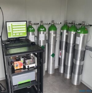
Reference Gas System: To maintain traceable and consistent gas measurements, the station includes a system of pressurized calibration cylinders connected to the analyzers, allowing for regular automatic calibration sequences.
The entire setup operates continuously and autonomously, with remote monitoring and routine maintenance ensuring high data quality.